
Picture 1 of 7


Picture 1 of 7


Scotland: Mapping the Nation. 2012 PB. Scottish Cartography History.

GBP 29.99
ApproximatelyAU $57.07
Condition:
“See Description.”
Postage:
International delivery of items may be subject to customs processing and additional charges.
Located in: Sheffield, United Kingdom
Delivery:
Estimated between Thu, 27 Jun and Fri, 5 Jul to 43230
Please allow additional time if international delivery is subject to customs processing.
Returns:
Payments:
Shop with confidence
Seller assumes all responsibility for this listing.
eBay item number:142534643128
Item specifics
- Condition
- Like new
- Seller notes
- “See Description.”
- Subject
- Geography & Geosciences, History
- Format
- Paperback
- Special Attributes
- Illustrated
- Date of Publication
- 2012
- ISBN
- 9781780270913
- Publication Year
- 2012
- Type
- Textbook
- Language
- English
- Publication Name
- Scotland: Mapping the Nation
- Item Height
- 250mm
- Publisher
- Birlinn General
- Item Width
- 246mm
- Item Weight
- 1387g
- Number of Pages
- 336 Pages
About this product
Product Information
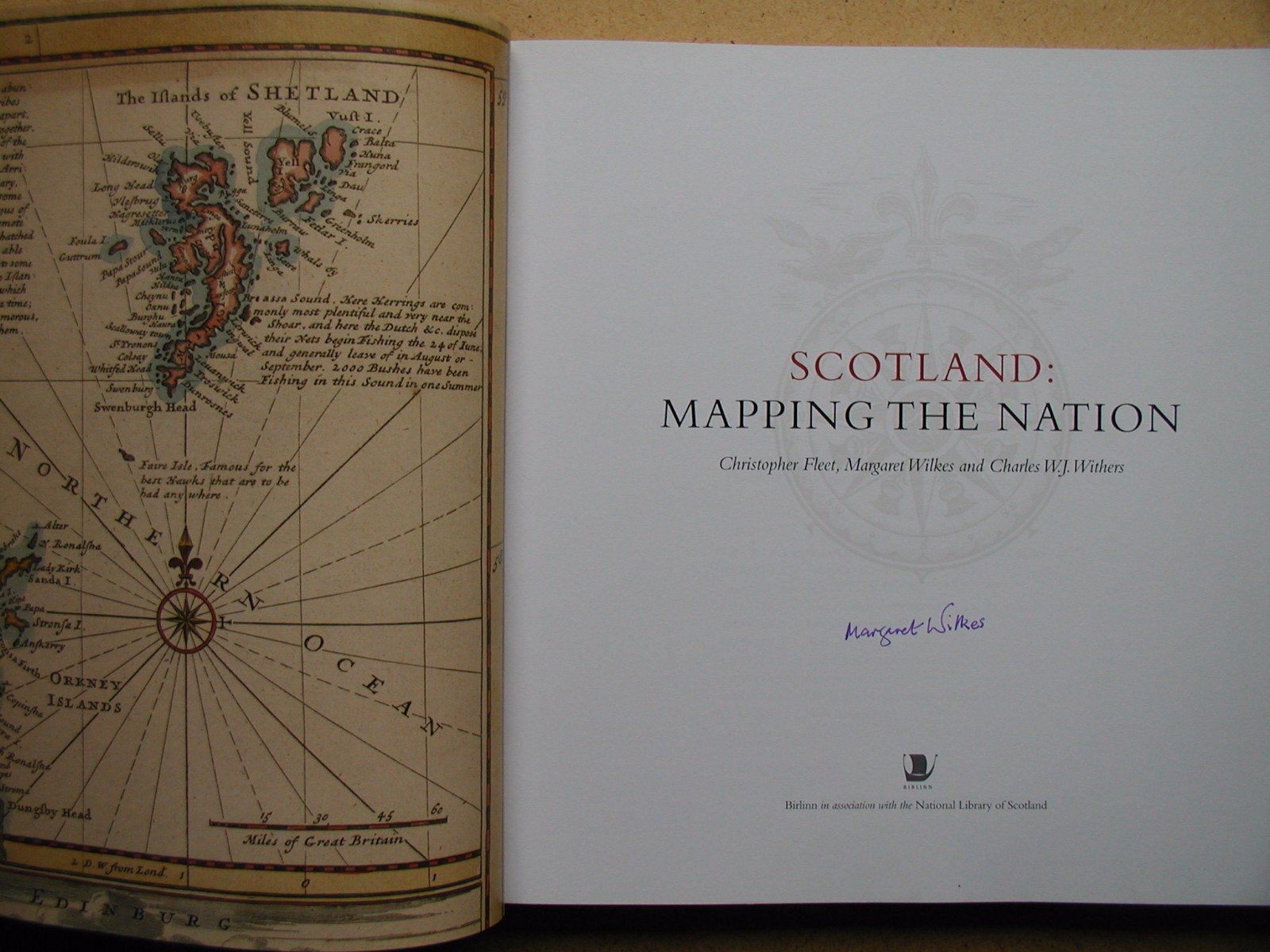
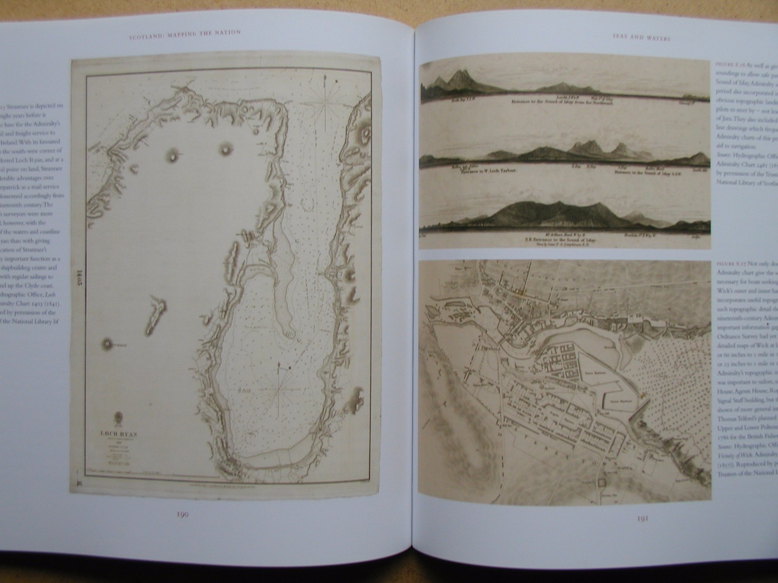
Whilst documents and other written material are obvious resources that help shape our view of the past, maps too can say much about a nation's history. Compiled by three experts who have spent their lives working with maps, Scotland: Mapping the Nation offers a fascinating and thought-provoking perspective on Scottish history which is beautifully illustrated with complete facsimiles and details of hundreds of the most significant manuscript and printed maps from the National Library of Scotland and other institutions, including those by Timothy Pont, Joan Blaeu and William Roy, amongst many others.
Product Identifiers
Publisher
Birlinn General
ISBN-13
9781780270913
eBay Product ID (ePID)
114850822
Product Key Features
Publication Name
Scotland: Mapping the Nation
Format
Paperback
Language
English
Subject
Geography & Geosciences, History
Publication Year
2012
Type
Textbook
Number of Pages
336 Pages
Dimensions
Item Height
250mm
Item Width
246mm
Item Weight
1387g
Additional Product Features
Country/Region of Manufacture
United Kingdom
Item description from the seller
Seller assumes all responsibility for this listing.
eBay item number:142534643128
Postage and handling
Item location:
Sheffield, United Kingdom
Posts to:
Americas, Asia, Australia, Egypt, Europe, New Zealand, Reunion, South Africa
Excludes:
Afghanistan, Libya, Nauru, Russian Federation, Somalia, Ukraine, Yemen
| Postage and handling | To | Service | Delivery*See delivery notes |
|---|---|---|---|
| GBP 18.50 (approx. AU $35.21) | United States | Standard postage (Royal Mail International Standard) |
| Handling time |
|---|
| Will usually post within 2 business days of receiving cleared payment. |
| Taxes |
|---|
| Taxes may be applicable at checkout. Learn moreLearn more about paying tax on eBay purchases. |
Sales tax for an item #142534643128
Sales tax for an item #142534643128
Seller collects sales tax for items posted to the following states:
| State | Sales tax rate |
|---|
Return policy
| Item must be returned within |
|---|
| 30 days after the buyer receives it |
The buyer is responsible for return postage costs.
You must return items in their original packaging and in the same condition as when you received them. If you don't follow our item condition policy for returnsitem condition policy for returns, you may not receive a full refund.
Refunds by law: In Australia, consumers have a legal right to obtain a refund from a business if the goods purchased are faulty, not fit for purpose or don't match the seller's description. More information at returnsreturns - opens in a new window or tab.
Payment details
Payment methods
Seller's payment instructions
None Specified

Seller Feedback (15,011)
e***p (50)- Feedback left by buyer.
Past 6 months
Verified purchase
Excellent communication from Seller. Item was well packaged and arrived promptly and was as described. Would certainly recommend this Seller.
b***8 (170)- Feedback left by buyer.
Past month
Verified purchase
Excellent seller, extremely speedy dispatch and delivery. Newspaper well packaged and protected in transit. Arrived in perfect condition. As described in detailed and accurate description. Pleasant transaction. Very happy with purchase. Would not hesitate to buy from this seller again.
b***e (1316)- Feedback left by buyer.
Past month
Verified purchase
Condition of book exactly as described, which was well packaged and despatched quickly. Excellent communications... Many thanks
Product ratings and reviews
Most relevant reviews
- 08 Jan, 2024
An excellent book in an excellent condition.
Verified purchase: YesCondition: Pre-ownedSold by: garden-house-hospice-trading
More to explore:
- Scottish Maps & Atlases,
- Scottish Maps & Atlases in English,
- National Geographic Folding Map Maps & Atlases,
- National Geographic Maps & Atlases,
- National Geographic Maps & Atlases in English,
- Australian Hema Maps Maps & Atlases,
- World Map,
- Street Maps/Directories,
- Melway Street Maps/Directories,
- Gregory's Street Maps/Directories