Picture 1 of 1
Gallery
Picture 1 of 1

Have one to sell?
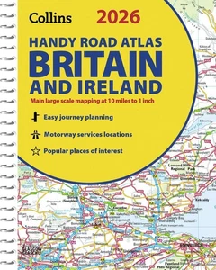
2026 Collins Handy Road Atlas Britain and Ireland: Clear and Detailed Map of Bri

AU $16.62
Condition:
Brand new
A new, unread, unused book in perfect condition with no missing or damaged pages. See the seller's listing for full details.
Last one19 sold
- Buy It Now2026 Collins Handy Road Atlas Britain and Ireland: Clear and Detailed Map of Bri
Oops! Looks like we're having trouble connecting to our server.
Refresh your browser window to try again.
Postage:
AU $15.16 International Standard : tracked-no signature (7 to 15 business days).
International delivery of items may be subject to customs processing and additional charges.
Located in: Melbourne, Australia
Delivery:
Estimated between Tue, 19 Aug and Fri, 29 Aug to 94104
Returns:
No returns accepted.
Payments:
4 payments of AU $4.16. Learn moreSee terms and apply now for Afterpay - opens in a new window or tab
Shop with confidence
Seller assumes all responsibility for this listing.
eBay item number:156769665001
Item specifics
- Condition
- ISBN-13
- 9780008719227
- Type
- Does not apply
- ISBN
- 9780008719227
- Book Title
- 2026 Collins Handy Road Atlas Britain and Ireland: Clear and Detailed Map of Britain and Ireland in Handy A5 Size with Spiral Binding (Collins Road Atlas)
- Publisher
- Harpercollins the Limited
- Item Length
- 8.3 in
- Publication Year
- 2025
- Format
- Spiral
- Language
- English
- Item Height
- 0.2 in
- Genre
- Travel, Reference
- Topic
- Atlases, Gazetteers & Maps (See Also Travel / Maps & Road Atlases), Maps & Road Atlases (See Also Reference / Atlases, Gazetteers & Maps), Europe / Great Britain
- Item Weight
- 4.7 Oz
- Item Width
- 5.9 in
- Number of Pages
- 80 Pages
About this product
Product Identifiers
Publisher
Harpercollins the Limited
ISBN-10
0008719225
ISBN-13
9780008719227
eBay Product ID (ePID)
23082459578
Product Key Features
Book Title
2026 Collins Handy Road Atlas Britain and Ireland: Clear and Detailed Map of Britain and Ireland in Handy A5 Size with Spiral Binding (Collins Road Atlas)
Number of Pages
80 Pages
Language
English
Topic
Atlases, Gazetteers & Maps (See Also Travel / Maps & Road Atlases), Maps & Road Atlases (See Also Reference / Atlases, Gazetteers & Maps), Europe / Great Britain
Publication Year
2025
Genre
Travel, Reference
Format
Spiral
Dimensions
Item Height
0.2 in
Item Weight
4.7 Oz
Item Length
8.3 in
Item Width
5.9 in
Additional Product Features
Intended Audience
Trade
Item description from the seller
Seller business information
VAT number: AU 82107909133, GB 293967539

Popular categories from this Store
Seller feedback (1,469,685)
This item (5)
All items (1,469,685)
- 6***0 (9)- Feedback left by buyer.Past 6 monthsVerified purchasequick deliver great little book with loads of detailed maps
- l***p (1232)- Feedback left by buyer.Past 6 monthsVerified purchaseGreat product and service
- a***i (78)- Feedback left by buyer.Past 6 monthsVerified purchaseGreat product
- e***e (702)- Feedback left by buyer.Past 6 monthsVerified purchaseCondition: The book is in excellent condition and just as described. Both the cover and pages have neither marks nor creases - each page is in perfect condition. Postage: The book arrived much quicker than anticipated. Packing: The book was solidly packed in a large cardboard-type envelope and securely sealed. Communication: I was sent several updates in regard to the postage, which was great. Overall: I highly recommend this seller and would definitely purchase from them again.
- 3***e (232)- Feedback left by buyer.Past 6 monthsVerified purchaseItem arrived as described, in perfect condition and in about a week. Well packaged in a large envelope and I thought it was well priced ... until I saw it elsewhere for half as much. Never mind, for a relatively low-priced item, I'm not too sore about paying more for this highly regarded tome. Good seller. Can recommended.
- c***c (465)- Feedback left by buyer.Past 6 monthsVerified purchaseA reliable and professional seller offering a wide range of items. Not always the cheapest option but certainly a store upon which you can depend. My goods were dispatched promptly, packaged appropriately and, upon receipt, found to be exactly as described. Communication throughout the process was good and I'd have no hesitation in purchasing from here in the future.Possibility (Wonder & Imagination) 500 Piece Jigsaw Puzzle by Paperblanks Hardco (#146371979206)
More to explore:
- Atlas Ireland,
- Collins Maps & Atlases,
- Road Atlas,
- Collins Maps & Atlases in English,
- Great Britain Maps & Atlases,
- Atlas Paperback Maps & Atlases in Portuguese,
- Atlas Paperback Maps & Atlases in Hebrew,
- Atlas Paperback Maps & Atlases in Malay,
- Atlas Paperback Maps & Atlases in Bengali,
- Atlas Paperback Large Print Maps & Atlases in English
Popular categories from this Store
Seller feedback (1,469,685)
This item (5)
All items (1,469,685)
- 6***0 (9)- Feedback left by buyer.Past 6 monthsVerified purchasequick deliver great little book with loads of detailed maps
- l***p (1232)- Feedback left by buyer.Past 6 monthsVerified purchaseGreat product and service
- a***i (78)- Feedback left by buyer.Past 6 monthsVerified purchaseGreat product
- e***e (702)- Feedback left by buyer.Past 6 monthsVerified purchaseCondition: The book is in excellent condition and just as described. Both the cover and pages have neither marks nor creases - each page is in perfect condition. Postage: The book arrived much quicker than anticipated. Packing: The book was solidly packed in a large cardboard-type envelope and securely sealed. Communication: I was sent several updates in regard to the postage, which was great. Overall: I highly recommend this seller and would definitely purchase from them again.
- 3***e (232)- Feedback left by buyer.Past 6 monthsVerified purchaseItem arrived as described, in perfect condition and in about a week. Well packaged in a large envelope and I thought it was well priced ... until I saw it elsewhere for half as much. Never mind, for a relatively low-priced item, I'm not too sore about paying more for this highly regarded tome. Good seller. Can recommended.
- c***c (465)- Feedback left by buyer.Past 6 monthsVerified purchaseA reliable and professional seller offering a wide range of items. Not always the cheapest option but certainly a store upon which you can depend. My goods were dispatched promptly, packaged appropriately and, upon receipt, found to be exactly as described. Communication throughout the process was good and I'd have no hesitation in purchasing from here in the future.Possibility (Wonder & Imagination) 500 Piece Jigsaw Puzzle by Paperblanks Hardco (#146371979206)