
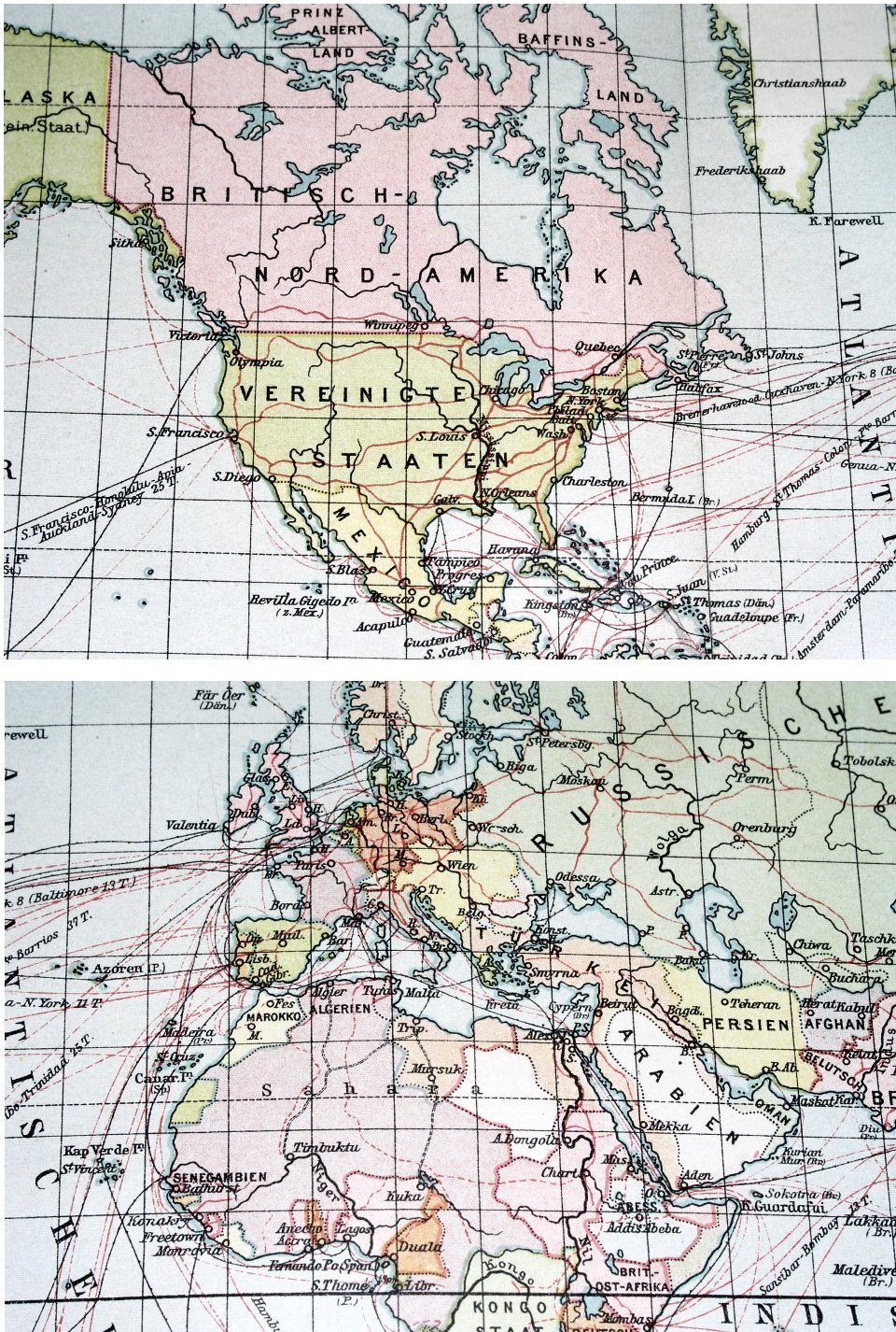
1905 ANTIQUE MAP OF THE WORLD / GERMAN BRITISH FRENCH COLONIES SHIP ROUTES
US $27.93US $27.93
Wed, 18 Jun, 11:43Wed, 18 Jun, 11:43
Picture 1 of 3


Gallery
Picture 1 of 3


Have one to sell?
1905 ANTIQUE MAP OF THE WORLD / GERMAN BRITISH FRENCH COLONIES SHIP ROUTES
US $27.93
ApproximatelyAU $42.92
or Best Offer
Condition:
“STAINS. THE MAP IS REINFORCED ON BACK ALONG THE CENTERFOLD.”
Oops! Looks like we're having trouble connecting to our server.
Refresh your browser window to try again.
Postage:
Free Standard Shipping from Canada.
International delivery of items may be subject to customs processing and additional charges.
Located in: Montreal, Quebec, Canada
Delivery:
Estimated between Tue, 26 Aug and Wed, 10 Sep to 94104
Returns:
60-day returns. Seller pays for return postage.
Payments:
Shop with confidence
Seller assumes all responsibility for this listing.
eBay item number:157089509714
Item specifics
- Seller notes
- “STAINS. THE MAP IS REINFORCED ON BACK ALONG THE CENTERFOLD.”
- Date Range
- 1900-1909
Item description from the seller
Seller Feedback
No Feedback yet
More to explore:
- British Colonial Antique Antique Desks,
- Antique World Maps & Atlases,
- World Antique World Wall Maps,
- World Antique World Maps & Atlases,
- Antique World Atlas Maps,
- Colonial Antique Antique Chairs,
- Colonial Colonial Silver Antiques,
- Antique Ship Equipment,
- 1960-1969 Date Range Antique World Maps & Atlases,
- Antique School Maps