Picture 1 of 1
Gallery
Picture 1 of 1

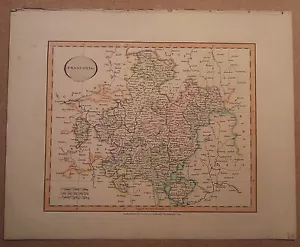
JOHN CARY MAP OF FRANCONIA 1813 FROM HIS New Elementary Atlas
GBP 65.00
ApproximatelyAU $134.08
or Best Offer
Condition:
- Buy It NowJOHN CARY MAP OF FRANCONIA 1813 FROM HIS New Elementary Atlas
Oops! Looks like we're having trouble connecting to our server.
Refresh your browser window to try again.
Postage:
GBP 10.25 (approx. AU $21.14) Royal Mail International Signed.
International delivery of items may be subject to customs processing and additional charges.
Located in: Diss, United Kingdom
Delivery:
Estimated between Fri, 9 May and Fri, 16 May
Please allow additional time if international delivery is subject to customs processing.
Returns:
14-day returns. Buyer pays for return postage. If you use an eBay postage label, it will be deducted from your refund amount.
Payments:
Shop with confidence
Seller assumes all responsibility for this listing.
eBay item number:192885595181
Item specifics
- Antique/ Modern
- Antique
- Map Type
- Historical/ Political
Item description from the seller
Seller feedback (19,497)
- 4***1 (373)- Feedback left by buyer.Past 6 monthsVerified purchaseI had an excellent experience purchasing banknotes from you! The communication was prompt and courteous, ensuring I felt confident throughout the transaction. The banknotes arrived swiftly and were packaged securely, preserving their pristine condition. The quality exceeded my expectations, matching the description perfectly. Highly recommended for anyone seeking trustworthy and professional service. Thank you!NEPAL BANKNOTES - Nepal National Bank - CHOOSE NOTE (#203041281313)
- k***a (2232)- Feedback left by buyer.Past 6 monthsVerified purchaseAs described in great condition. Good price. Well packed. Fast delivery. Very pleased with the service.AUSTRIA BANKNOTE 2 P50 1.03.1917 (1919) AU (#196425055668)
- k***j (835)- Feedback left by buyer.Past 6 monthsVerified purchaseGreat seller! Great communication. Item arrived quickly and was just as described. Thanks, very pleased.
More to explore:
- Antique Atlas Maps,
- Antique World Atlas Maps,
- Antique Europe Atlas Maps,
- City Map Antique North America Atlas Maps,
- County Map Antique Atlas,
- Atlas Antique African Maps & Atlases,
- North Dakota Antique North America Atlas Maps,
- Antique Atlas Maps 1800-1899 Date Range and Globes,
- Antique European Maps & Atlases John Speed,
- 1800-1899 Date Range Antique Europe Atlas Maps