
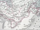
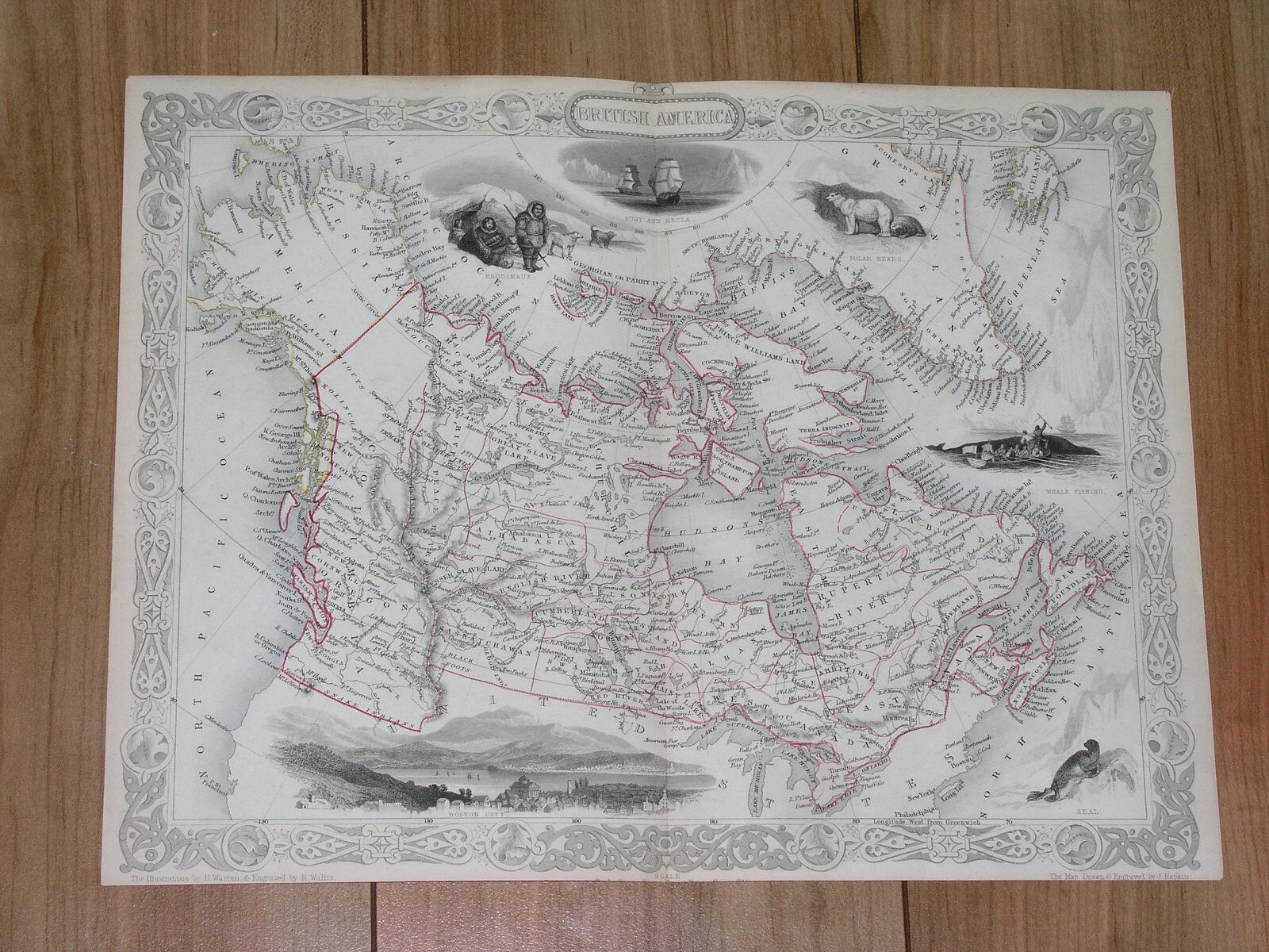
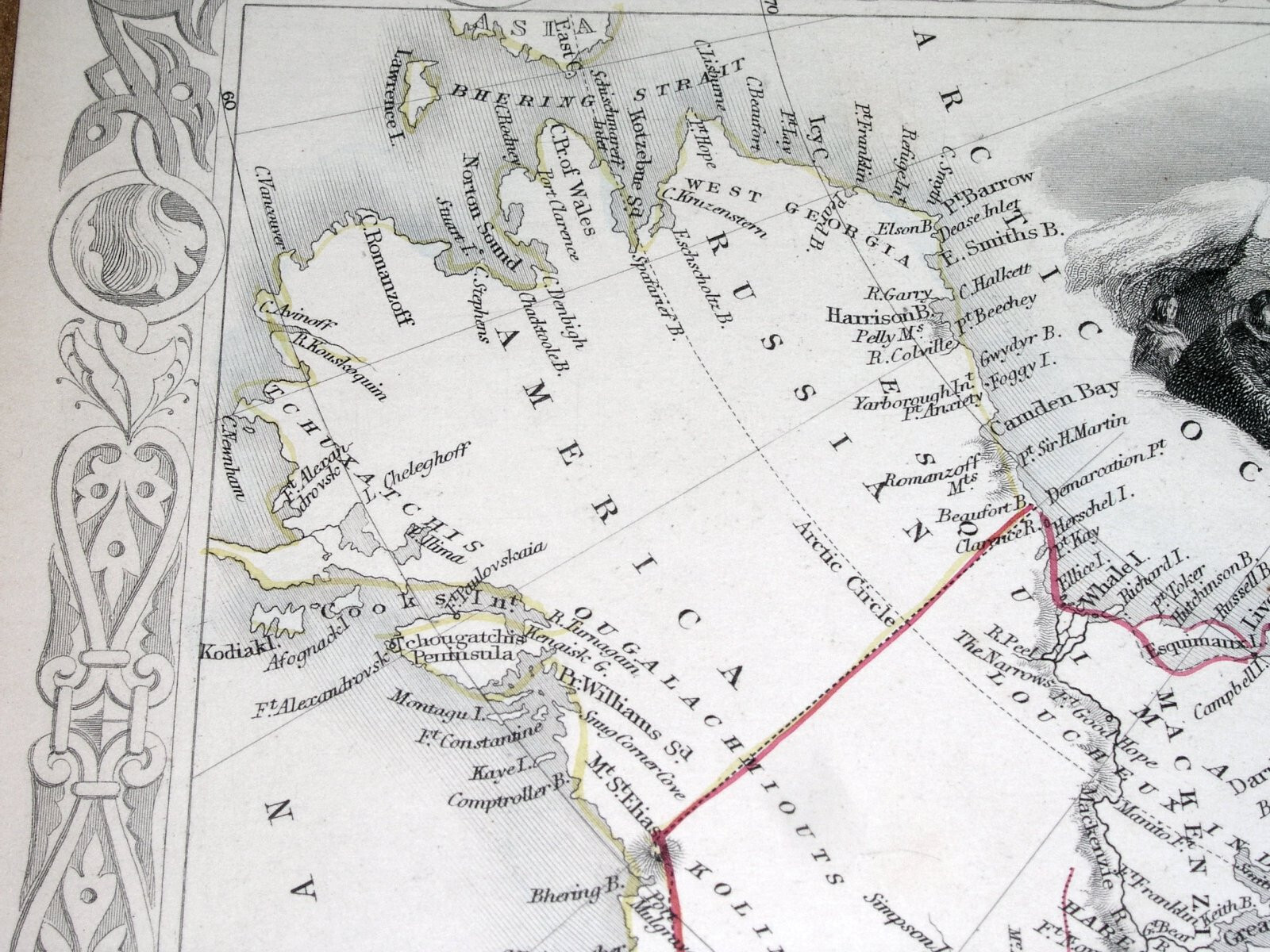
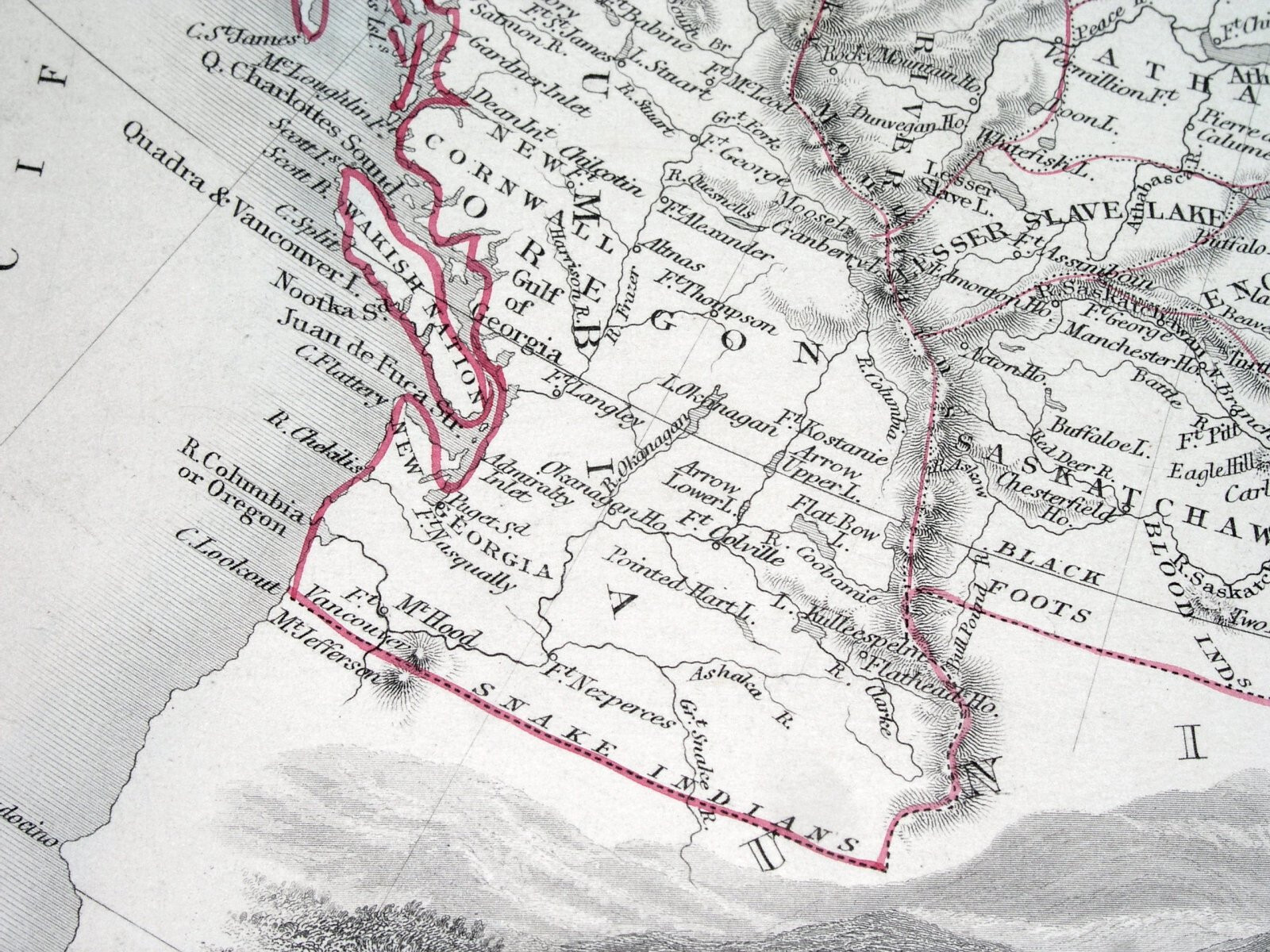
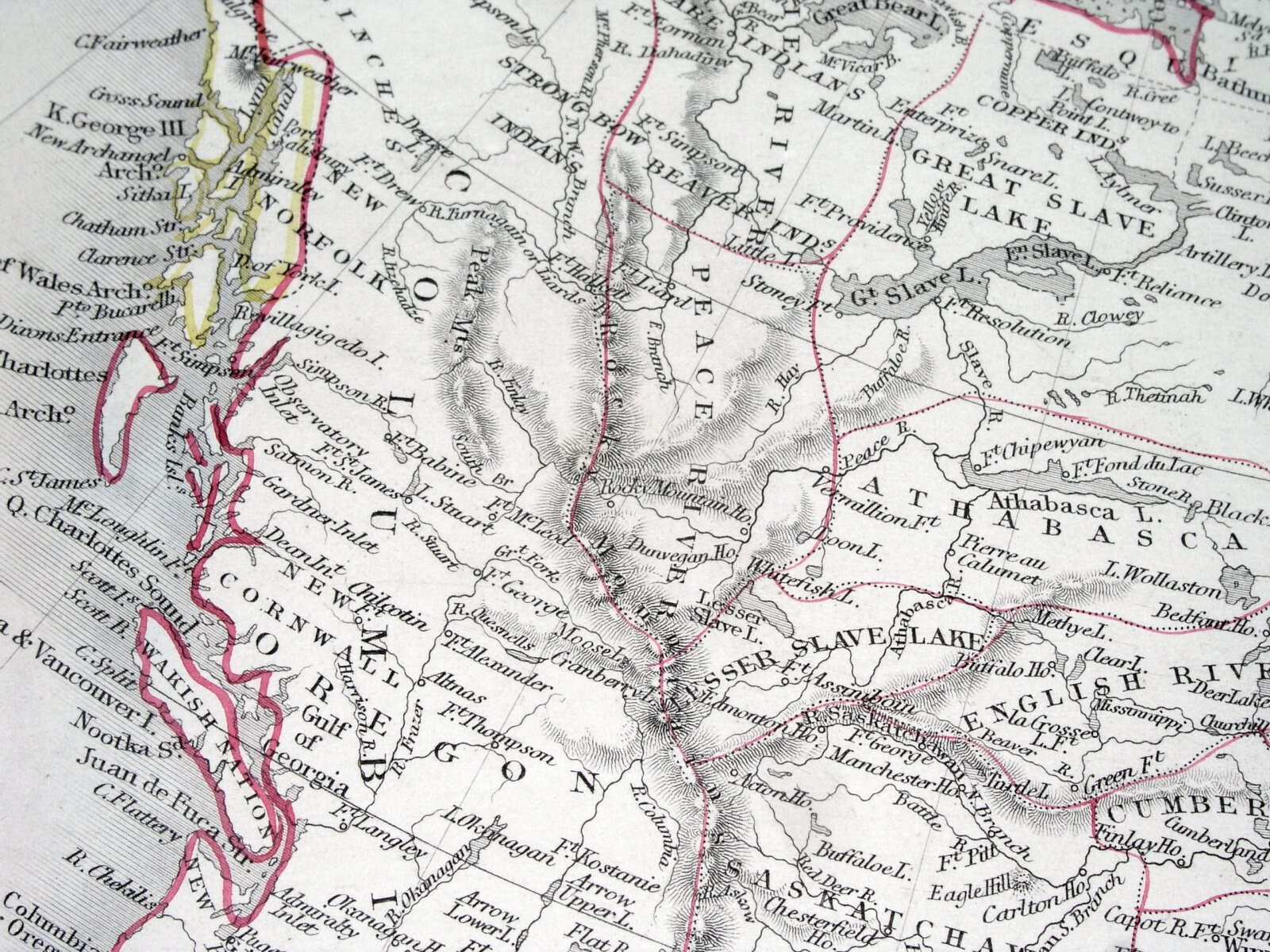
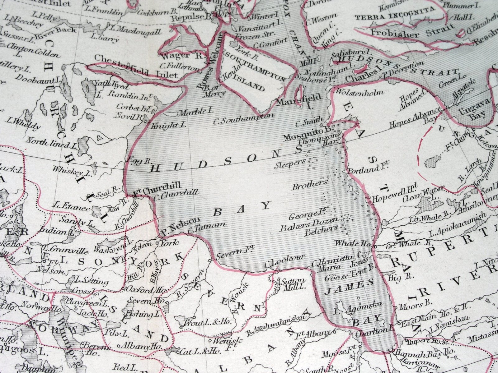
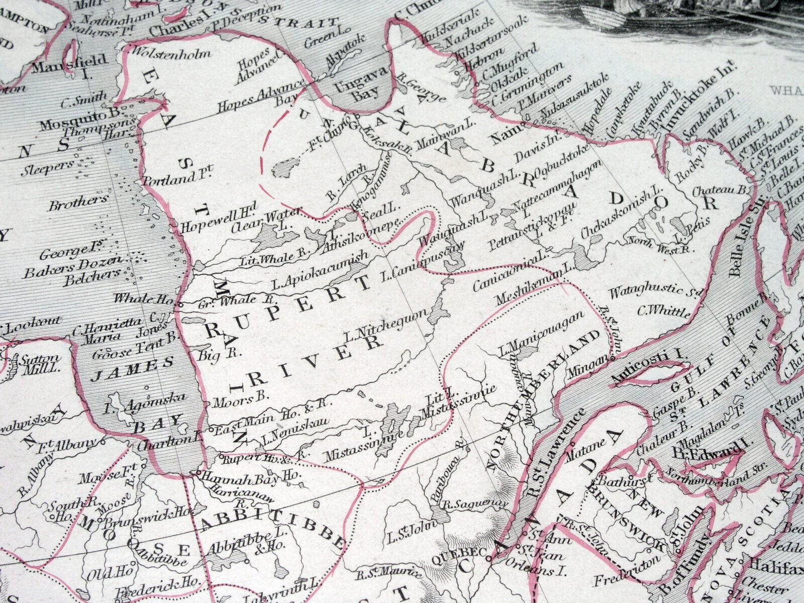
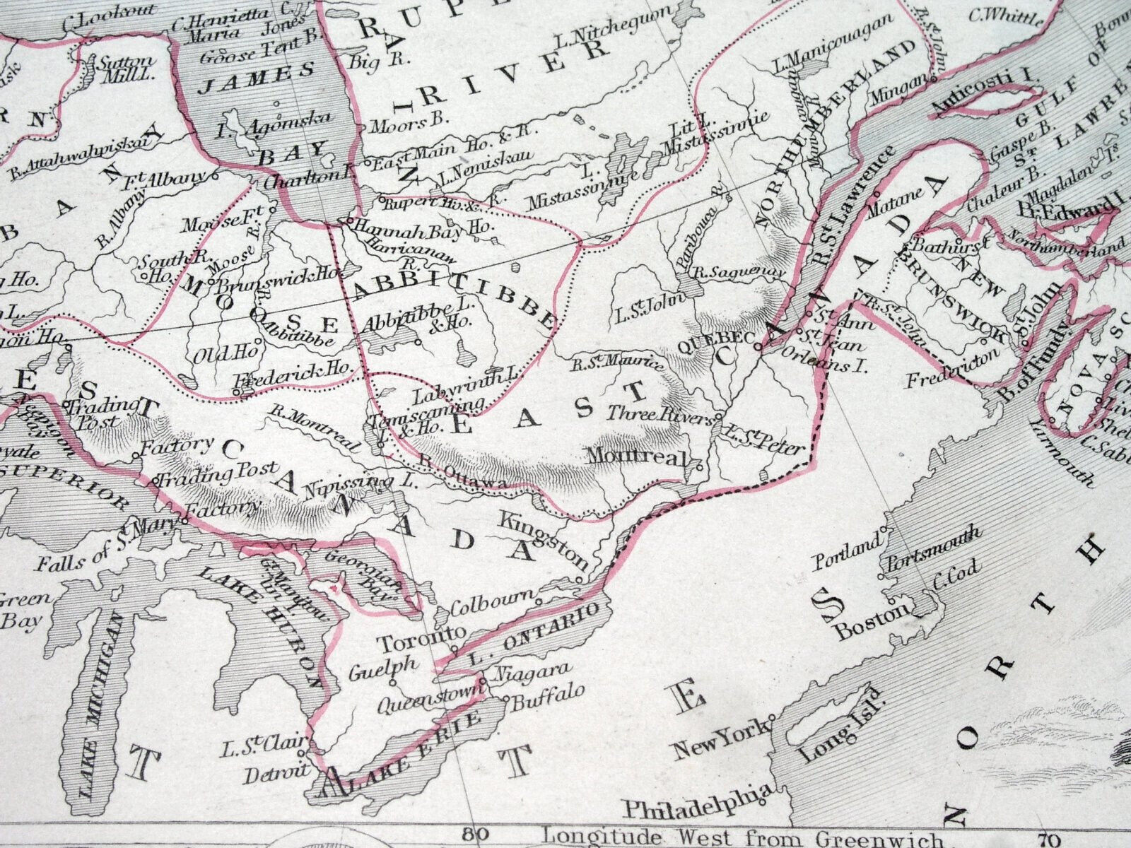
1849 TALLIS RAPKIN MAP BRITISH AMERICA CANADIAN WASHINGTON RUSSIAN ALASKA CANADA
US $250.00US $250.00
Tue, 05 Aug, 09:37Tue, 05 Aug, 09:37
Picture 1 of 18


Gallery
Picture 1 of 18


Have one to sell?
1849 TALLIS RAPKIN MAP BRITISH AMERICA CANADIAN WASHINGTON RUSSIAN ALASKA CANADA

US $250.00
ApproximatelyAU $383.20
or Best Offer
Condition:
“GOOD / FOLDED IN HALF, AS ORIGINALLY ISSUED.”
Oops! Looks like we're having trouble connecting to our server.
Refresh your browser window to try again.
Postage:
US $6.00 (approx. AU $9.20) Economy Shipping.
International delivery of items may be subject to customs processing and additional charges.
Located in: Montreal, Quebec, Canada
Delivery:
Estimated between Mon, 11 Aug and Thu, 21 Aug to 94104
Returns:
30-day returns. Seller pays for return postage.
Payments:
Shop with confidence
Seller assumes all responsibility for this listing.
eBay item number:286728209135
Item specifics
- Seller notes
- “GOOD / FOLDED IN HALF, AS ORIGINALLY ISSUED.”
- Date Range
- 1800-1899
- US State
- Alaska, Washington
- Canadian Province
- Alberta, British Columbia, Manitoba, New Brunswick, Newfoundland & Labrador, Northwest Territories, Nova Scotia, Nunavut, Ontario, Prince Edward Island, Quebec, Saskatchewan, Yukon
- Year
- 1849
- Cartographer/Publisher
- Tallis
- Country/Region
- Canada
Item description from the seller

Seller Feedback
No Feedback yet
More to explore:
- Antique North American Maps & Atlases Washington,
- City Map Antique North America Atlas Maps,
- Topographical Map Antique North America Folding Maps,
- Topographical Map Antique North America Atlas Maps,
- Antique North America County Maps,
- Antique North America Folding Maps,
- United States of America Antique North America Folding Maps,
- California Antique North America Folding Maps,
- Maine Antique North America County Maps,
- United States of America California Antique North America Maps & Atlases
Seller Feedback
No Feedback yet