
Picture 1 of 3


ENDED
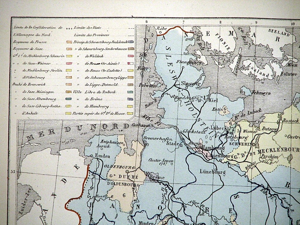
1866 Map Northern Germany Confederation Hand Colored Lithograph 11.5 x 9.5"
Condition:
“See photos for condition description. Pictures are of the actual item(s) you will receive.”
Price:
US $31.40
ApproximatelyAU $47.43
Postage:
Located in: Belton, Missouri, United States
Delivery:
Estimated between Sat, 11 May and Tue, 14 May to 43230
Returns:
Payments:
Shop with confidence
Seller information
- 100% positive Feedback
Registered as a business seller
Seller assumes all responsibility for this listing.
eBay item number:315061509538
Item specifics
- Seller notes
- “See photos for condition description. Pictures are of the actual item(s) you will receive.”
- County
- Various
- Cartographer/Publisher
- Hachette
- Printing Technique
- Lithography
- Original/Reproduction
- Antique Original
- Format
- Atlas Map
- Type
- Political Map
- Year
- 1866
- City
- Various
- Date Range
- 1800-1899
- Country/Region
- Germany
- State
- Germany
Item description from the seller
Seller assumes all responsibility for this listing.
eBay item number:315061509538
Postage and handling
Item location:
Belton, Missouri, United States
Posts to:
Americas, Asia, Australia, Europe
Excludes:
Barbados, French Guiana, French Polynesia, Germany, Guadeloupe, Libya, Martinique, New Caledonia, Reunion, Russian Federation, Ukraine, Venezuela
| Postage and handling | To | Service | Delivery*See delivery notes |
|---|---|---|---|
| US $6.50 (approx. AU $9.82) | United States | Standard postage (USPS Ground Advantage®) | Estimated between Sat, 11 May and Tue, 14 May to 43230 |
| US $9.50 (approx. AU $14.35) | United States | Express Postage (USPS Priority Mail®) | Estimated between Sat, 11 May and Tue, 14 May to 43230 |
| Handling time |
|---|
| Will usually post within 1 business day of receiving cleared payment. |
| Taxes |
|---|
| Seller charges sales tax in |
Sales tax for an item #315061509538
Sales tax for an item #315061509538
Seller collects sales tax for items posted to the following states:
| State | Sales tax rate |
|---|---|
| Missouri (MO)* | 9.1% |
Return policy
| Item must be returned within | Refund will be given as |
|---|---|
| 30 days after the buyer receives it | Money back |
The buyer is responsible for return postage costs.
You must return items in their original packaging and in the same condition as when you received them. If you don't follow our item condition policy for returnsitem condition policy for returns, you may not receive a full refund.
Refunds by law: In Australia, consumers have a legal right to obtain a refund from a business if the goods purchased are faulty, not fit for purpose or don't match the seller's description. More information at returnsreturns - opens in a new window or tab.
Payment details
Payment methods

More to explore:
- Antique European Maps & Atlases Germany,
- Antique European Maps & Atlases Germany 1800-1899 Date Range,
- County Map Antique Europe Sheet Maps,
- Antique School Maps,
- City Map Antique North America Atlas Maps,
- Topographical Map Antique Australia/Oceania Atlas Maps,
- Topographical Map Antique North America Folding Maps,
- Antique Topographical Maps,
- Australia Antique Maps & Atlases,
- Antique World Wall Maps