
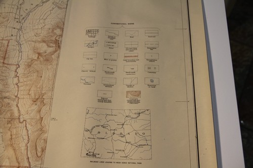
MESA VERDE NATIONAL PARK COLORADO - VINTAGE USGS TOPOGRAPHIC MAP 1948 - 45"x31"
US $49.95US $49.95
Fri, 27 Jun, 01:19Fri, 27 Jun, 01:19
Picture 1 of 16


Gallery
Picture 1 of 16


Have one to sell?
MESA VERDE NATIONAL PARK COLORADO - VINTAGE USGS TOPOGRAPHIC MAP 1948 - 45"x31"
US $49.95
ApproximatelyAU $76.59
or Best Offer
Condition:
“In good condition, there is a tear and some paper missing top right (see pictures) - does not ”... Read moreabout condition
Oops! Looks like we're having trouble connecting to our server.
Refresh your browser window to try again.
Postage:
US $7.95 (approx. AU $12.19) USPS Ground Advantage®.
Located in: Dana Point, California, United States
Delivery:
Estimated between Tue, 12 Aug and Fri, 15 Aug to 94104
Returns:
30-day returns. Seller pays for return postage.
Payments:
Shop with confidence
Seller assumes all responsibility for this listing.
eBay item number:396775464672
Item specifics
- Seller notes
- Date Range
- 1948
- Type
- Topographical Map
- Format
- Wall Map
- Printing Technique
- unknown
- US State
- Colorado
- Year
- 1948
- Original/Reproduction
- Vintage Original
- Cartographer/Publisher
- USGS
- City
- Mesa Verde National Park
- Country/Region
- United States of America
Item description from the seller
Seller Feedback
No Feedback yet
More to explore:
- Antique Topographical Maps,
- Vintage Original Antique Australia/Oceania Topographical Maps,
- Vintage Original Antique North America Topographical Maps,
- Lithography Antique Topographical Maps,
- Antique World Topographical Maps,
- Topographical Map Antique Australia/Oceania Atlas Maps,
- Lithography Antique Australia/Oceania Topographical Maps,
- Australia Antique Australia/Oceania Topographical Maps,
- 1800-1899 Date Range Antique Topographical Maps,
- Vintage Reproduction Antique Wall Maps