
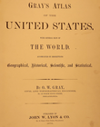
1876 Map ~ CHICAGO, ILLINOIS - (14x17)-#004
US $45.95US $45.95
Thu, 03 Jul, 02:40Thu, 03 Jul, 02:40
Picture 1 of 3


Gallery
Picture 1 of 3


Have one to sell?
1876 Map ~ CHICAGO, ILLINOIS - (14x17)-#004
US $45.95
ApproximatelyAU $70.62
or Best Offer
Was US $48.88
Save US $2.93 (6% off)
Condition:
“This map is not *new* or in *new* condition. It was printed in 1876. See photo for the best ”... Read moreabout condition
Ended: 03 Jul, 2025 02:40:13 AEST
Oops! Looks like we're having trouble connecting to our server.
Refresh your browser window to try again.
Postage:
Free USPS Ground Advantage®.
Located in: Schertz, Texas, United States
Delivery:
Estimated between Sat, 23 Aug and Fri, 29 Aug to 94104
Returns:
30-day returns. Seller pays for return postage.
Payments:
Shop with confidence
Seller assumes all responsibility for this listing.
eBay item number:405395722740
Item specifics
- Seller notes
- Date Range
- 1876
- Ref
- the title page & book cover are only for reference purposes
- US State
- Illinois
- Year
- 1876
- S&H
- Free S&H USA - Calculated S&H Worldwide
- Size
- the page is 14x17
- Color
- hand tinted highlights
- Cartographer/Publisher
- O. W. Gray / John W. Lyon & Co.
- Original/Reproduction
- Antique Original
- City
- Chicago
- Age
- over 140 years old
Item description from the seller
Seller Feedback
No Feedback yet
More to explore:
- Antique North American Maps & Atlases Illinois,
- Illinois Antique North America County Maps,
- Illinois Antique Original Antique North America Maps & Atlases,
- United States of America Illinois Antique North America Maps & Atlases,
- Illinois Antique North America Maps & Atlases 1800-1899 Date Range,
- Antique School Maps,
- Australia Antique Maps & Atlases,
- Antique Physical Maps,
- Antique Atlas Maps,
- Antique Folding Maps