
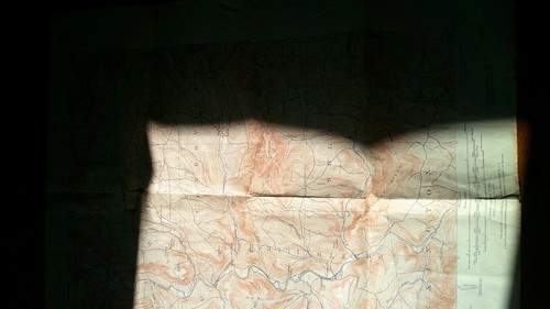
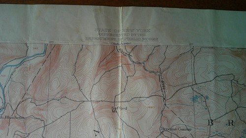
FOUR 1940's USGS topographic maps, Bolton, Hobart, Schoharie & Gilboa New York
US $9.98US $9.98
Mon, 02 Jun, 23:53Mon, 02 Jun, 23:53
Picture 1 of 14


Gallery
Picture 1 of 14


Have one to sell?
FOUR 1940's USGS topographic maps, Bolton, Hobart, Schoharie & Gilboa New York
Condition:
“All have been folded and used. One has tape on the back. My father used these for hunting.”
Ended: 02 Jun, 2025 23:53:53 AEST
Oops! Looks like we're having trouble connecting to our server.
Refresh your browser window to try again.
Postage:
US $8.75 (approx. AU $13.47) USPS Ground Advantage®.
Located in: Rexford, New York, United States
Delivery:
Estimated between Tue, 19 Aug and Mon, 25 Aug to 94104
Returns:
No returns accepted.
Payments:
Shop with confidence
Seller assumes all responsibility for this listing.
eBay item number:405899972051
Item specifics
- Seller notes
- “All have been folded and used. One has tape on the back. My father used these for hunting.”
- Date Range
- 1940-1949
- Type
- Topographical Map
- US State
- New York
- Format
- Folding Map
- Original/Reproduction
- Vintage Original
- Cartographer/Publisher
- USGS
- Country/Region
- United States of America
Item description from the seller
Seller Feedback
No Feedback yet
More to explore:
- Antique Topographical Maps,
- New York New York Antique North America Maps & Atlases,
- Lithography Antique Topographical Maps,
- Antique World Topographical Maps,
- New York Antique North America City Maps,
- Topographical Map Antique North America Folding Maps,
- Vintage Original Antique Australia/Oceania Topographical Maps,
- United States of America Antique North America Topographical Maps,
- New York 1800-1899 Date Range Antique North America Maps & Atlases,
- 1800-1899 Date Range Antique North America Topographical Maps