
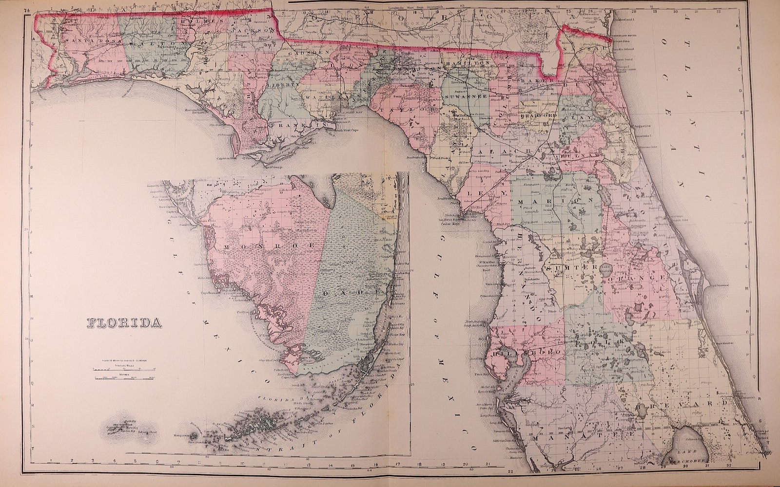
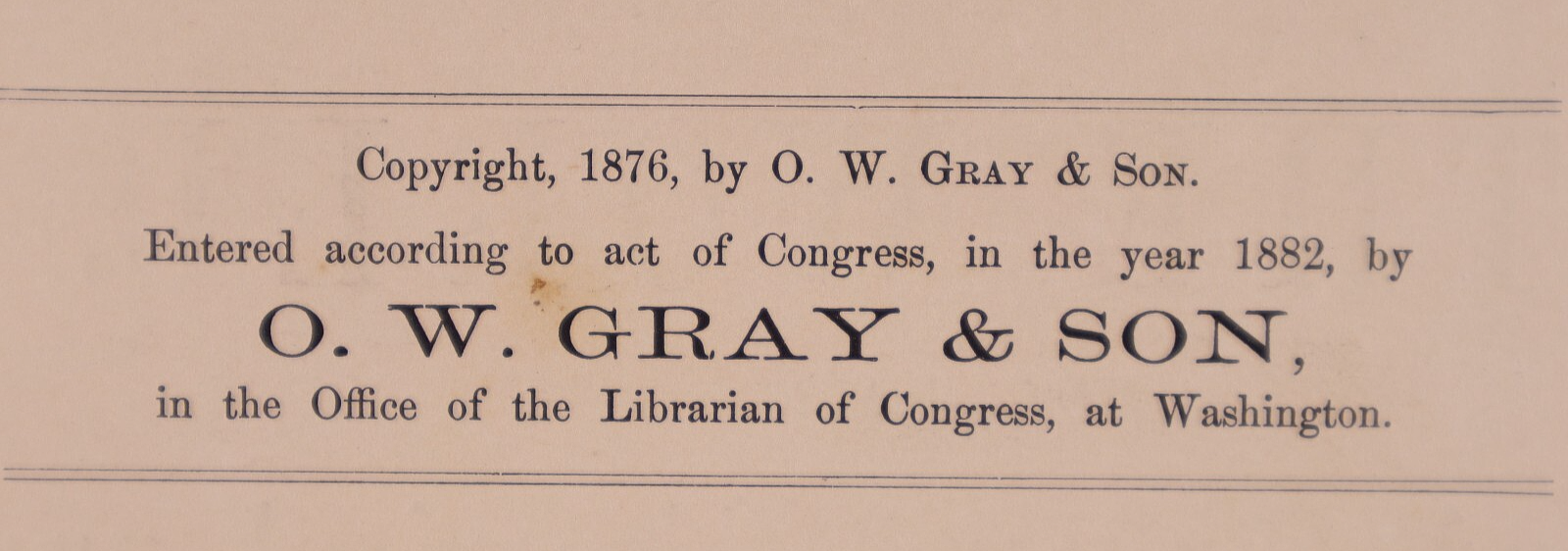
1882 Map of FLORIDA by Frank A. Gray ~ (17x27)-#20
US $34.00US $34.00
Thu, 31 Jul, 05:15Thu, 31 Jul, 05:15
Picture 1 of 2


Gallery
Picture 1 of 2
Have one to sell?
1882 Map of FLORIDA by Frank A. Gray ~ (17x27)-#20

Condition:
“This map is not *new* or in *new* condition. It was printed in 1882 and removed from an antique ”... Read moreabout condition
Ended: 31 Jul, 2025 05:15:00 AEST
Oops! Looks like we're having trouble connecting to our server.
Refresh your browser window to try again.
Postage:
Free USPS Ground Advantage®.
Located in: Schertz, Texas, United States
Delivery:
Estimated between Sat, 16 Aug and Fri, 22 Aug to 94104
Returns:
30-day returns. Seller pays for return postage.
Payments:
Shop with confidence
Seller assumes all responsibility for this listing.
eBay item number:406077586685
Item specifics
- Seller notes
- Date Range
- 1800-1899
- Type
- State Map
- Format
- Atlas Map
- US State
- Florida
- Year
- 1882
- Original/Reproduction
- Antique Original
- Cartographer/Publisher
- O. W. Gray
- Country/Region
- United States of America
Item description from the seller

Seller feedback (9,645)
- w***3 (317)- Feedback left by buyer.Past monthVerified purchaseWhat should have been a speedy delivery via Ground Advantage delayed due to the incompetence of the USPS. Item sent from Texas to Chicago, then to Pennsylvania (!), the back to Chicago, finally delivered on July 22. The seller did everything right: prompt shipping, excellent packaging, item as described and worth the price. The score: Seller 10, USPS 0.
- o***d (889)- Feedback left by buyer.Past monthVerified purchaseItem exactly as described and shipped in a very protective package. It took almost 3 weeks for the shipping but the shipping was included in the price. Very good value and worth waiting for. Thank you!
- 1***l (18)- Feedback left by buyer.Past 6 monthsVerified purchaseFinally! The "ancestral plat map" arrived and is well worth the long wait!. It is as nice or even nicer than what the seller described. It was packaged adequately, I don't know why it took from 11 April to 5 May to be delivered, but I suspect this was outside the control/responsibility of the seller. I am grateful that this irreplaceable old document was not forever "lost in the mail." Thank you, thank you, thank you!1872 Plat Map ~ FENTON Twp., WHITESIDE Co., ILLINOIS - (15x18)-#10 (#405722860174)
More to explore:
- Antique North American Maps & Atlases Florida,
- Antique School Maps,
- County Map Antique Europe Sheet Maps,
- City Map Antique North America Atlas Maps,
- Australia Antique Maps & Atlases,
- Antique Wall Maps,
- Antique Maps, Atlases & Globes,
- Antique World Atlas Maps,
- Antique World Maps & Atlases,
- Antique Asia Maps & Atlases
Seller feedback (9,645)
- w***3 (317)- Feedback left by buyer.Past monthVerified purchaseWhat should have been a speedy delivery via Ground Advantage delayed due to the incompetence of the USPS. Item sent from Texas to Chicago, then to Pennsylvania (!), the back to Chicago, finally delivered on July 22. The seller did everything right: prompt shipping, excellent packaging, item as described and worth the price. The score: Seller 10, USPS 0.
- o***d (889)- Feedback left by buyer.Past monthVerified purchaseItem exactly as described and shipped in a very protective package. It took almost 3 weeks for the shipping but the shipping was included in the price. Very good value and worth waiting for. Thank you!
- 1***l (18)- Feedback left by buyer.Past 6 monthsVerified purchaseFinally! The "ancestral plat map" arrived and is well worth the long wait!. It is as nice or even nicer than what the seller described. It was packaged adequately, I don't know why it took from 11 April to 5 May to be delivered, but I suspect this was outside the control/responsibility of the seller. I am grateful that this irreplaceable old document was not forever "lost in the mail." Thank you, thank you, thank you!1872 Plat Map ~ FENTON Twp., WHITESIDE Co., ILLINOIS - (15x18)-#10 (#405722860174)