Vue plan de la ville de MONTMÉLIAN en Savoie, gravure estampe originale de 1638.
AU $105.89
VUE PLAN CARTE DE LA VILLE DE GRONINGUE GRONINGEN Gravure des Pays-Bas 1769
AU $89.60
Indicateur et plans de Paris par Beadeker en 1898, nombreuses cartes dépliantes
AU $73.31
L'EUROPE EUROPA carte plan géographique de Bonne en 1787 antic old map
AU $97.74
Carte géographique ancienne par Jan Jansson à Amsterdam 1666 LE DAUPHINÉ
AU $276.93
Vue plan de la ville de GRENOBLE, gravure estampe originale de 1638
AU $97.74
VUE LA VILLE DE KAMPEN AU PAYS-BAS gravure originale ancienne Guicciardini 1613
AU $154.76
ILES DES PETITES CARAIBES, GUADELOUPE, MARTINIQUE carte géographique 1787 map
AU $154.76
VUE PLAN DE BOIS-LE-DUC 's-Hertogenbosch gravure des DÉLICES DES PAYS-BAS 1769
AU $81.45
TRAITÉ DES PIERRES GRAVÉS par Pierre Jean MARIETTE 1750, 197 gravures hors texte
AU $4,561.21
LA LIGURIE VENITIE LOMBARDIE en ITALIE carte géographique ancienne 1787l old map
AU $105.89
1861 Carte géographique ancienne DÉPARTEMENT DE L'ARIEGE, RÉGION DE FOIX map
AU $48.87
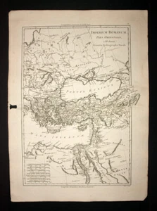
L'EMPIRE ROMAIN ORIENTAL carte géographique de Bonne en 1787 antic old map
AU $97.74
RÉGION DE MELUN, FONTAINEBLEAU, SENS, PROVINS plan carte geographique ancienne
AU $57.02
MAUSOLÉE DE GUILLAUME 1er D'ORANGE-NASSAU gravure des DÉLICES DES PAYS-BAS 1769
AU $73.31
Carte géographique ASIE ASIA, ex magna orbis terre descriptione, Gerard Mercator
AU $1,954.81
programme gravé ADOLPHE WILLETTE, EXPOSITION INTERNATIONAL DES PRODUITS, 1893
AU $65.16
BATEAUX ET BARQUES AU JAPON Gravure originale du 18eme sur cuivre
AU $57.02
NOUVEL ATLAS DE GEOGRAPHIE 64 cartes par C. CORTAMBERT XIXeme old antic map
AU $374.67
MAPPEMONDE GLOBE TERRESTRE Carte ancienne originale par HOMANN 1746 antique map
AU $1,954.81
Plan région de la ville de LIMOGES Carte géographique ancienne du 19eme siècle
AU $65.16
STELLATUM PLANISPHAERIUM Par VLASBLOM Ludovico de 1681, carte celeste ancienne
AU $2,443.51
Vue plan de la ville de MONTMÉLIAN et MIOLANS, gravure estampe originale de 1638
AU $89.60
Spain Espana Monks And Charité engraving 1845
AU $32.40
RÉGION DE LANDAU, DEUX-PONTS, WISSEMBOURG carte originale de Cassini du 18eme
AU $138.47
Carte de LA GUYANE FRANÇAISE, SURINAME, gravure originale de voyage 1798, map
AU $97.74
Boats And Boats IN Japan engraving Original From 18eme On Copper
AU $63.95
RÉGION DE BRUXELLES, MONS, NAMUR, LOUVAIN plan carte geographique ancienne
AU $57.02
CHERBOURG-EN-CONTENTIN, VALOGNES, PÉNINSULE DU CONTENTIN carte plan geographique
AU $57.02
Circle Of Bass Saxe map Geographic old, Old Antique Map Bonne 1787
AU $75.02
Gaming Power Plant ISLE OF Sumatra map geographic old Vandermaelen 1827
AU $112.57
MAPPEMONDE GLOBE TERRESTRE AMERIQUE NORD ET SUD carte géographique de BONNE 1787
AU $146.61
Geographic Map Department LOT ET GARONNE 1836
AU $38.38
Department of Seine and Oise Versailles Paris Etampes
AU $39.22
Circle Of High Saxe map Geographic old, Old Antique Map Bonne 1787
AU $75.02
DEPARTEMENT DU JURA Lons le Saunier Salins Orgelet 1823
AU $32.58
Region de SAINTE FOY LA GRANDE, CASTILLON LA BATAILLE Carte géographique 19eme
AU $57.02
The Islands Low Australasia map geographic old No 48 of Vandermaelen 1827
AU $112.57
High and Low Pyrenees Garonne Coats of Arms Engraving 1850
AU $56.27
Archipel Of Islands Low map geographic No 49 of Vandermaelen 1827
AU $112.57
Archipel Of Islands Low map geographic No 43 of Vandermaelen 1827
AU $112.57
RÉGION DE MOULINS, MONTLUCON, LA CHÂTRE, GANNAT plan carte geographique ancienne
AU $57.02
Island Gilolo map geographic old No 15 of Vandermaelen 1827
AU $112.57
Part Of L'Archipel Bismarck map geographic old Vandermaelen 1827
AU $112.57
L'ALLEMAGNE, LA BOHEME... carte geographique ancienne, old antic map BONNE 1787
AU $57.02
Gaming Of Islands Cook map geographic old Vandermaelen 1827
AU $112.57
Circle Of High Saxe South map Geographic old, Old Antique Map Bonne 1787
AU $83.55
Island de La Queen Charlotte map Geographic old Old Antique Map Bonne 1787
AU $100.62
About us
Bienvenue. Je vends DES GRAVURES ORIGINALES DU 15eme au 19eme SIECLE. Je suis professionnel depuis 20 ans et je suis soucieux de la qualité de ma prestation et du rapport avec mes clients.
Location: FranceMember since: 18 April 2005Seller: the.katz
Top Rated Sellerlibrairie maxime is one of eBay's most reputable sellers. Consistently delivers outstanding customer service Learn more
Business details
Business name: KATZ MAXIMEFirst name: maximeLast name: katzAddress: 17 cours Tolstoi, 69100 Villeurbanne, FrancePhone number: 0680207388Email: maxime.katz@gmail.com
Heureuse d'avoir reçu le document. Tel que sur la photo. Bien protégé et emballé.
Un peu cher vu l'état, mais il est vrai qu'il est de 1791.
l***a (947)- Feedback left by buyer.
Past 6 months
Verified purchase
Très bon contact, envoi rapide, emballage solide +++
l***a (947)- Feedback left by buyer.
Past 6 months
Verified purchase
Très bon contact, envoi rapide, emballage solide +++
b***l (197)- Feedback left by buyer.
Past 6 months
Verified purchase
carte conforme à l'annonce. envoi rapide et très bien emballé.
merci beaucoup
p***u (4)- Feedback left by buyer.
Past 6 months
Verified purchase
Vendeur compétent et très professionnel. L'objet reçu très rapidement est parfaitement conforme à l'annonce. Je recommande cette librairie de livres et documents anciens.
5***- (2)- Feedback left by buyer.
Past 6 months
Verified purchase
Vendeur adorable ainsi qu'emballage parfait et envoi rapide. Vraiment parfait !